Pangalan Canal, the longest waterway in the world
The multifaceted history of this pharaonic structure
I would like to take the hint of a good friend as an opportunity to say something about the famous "Canal des Pangalanes to write. While I almost always agree with my friend on issues concerning the red island, when he says that this "pharaonic construction" has been forgotten, he is mistaken! Numerous French sources report about the Canal des Pangalanes and also at colorful stories and occult lore of the natives is not lacking. In German, on the other hand, one finds only little literature on this impressive waterway. All the more rewarding is an exploration of this mysterious area. In recent years, especially those interested in sports have taken advantage of the boat tours organized by local hoteliers and tour operators on individual sections of the canal. Even though the canal has been badly damaged over the years, it is worthwhile to take, for instance, a Boat tour through the mountain cloud forest.
The longest waterway in the world
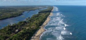
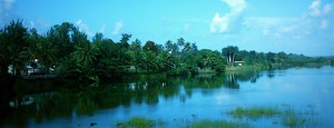
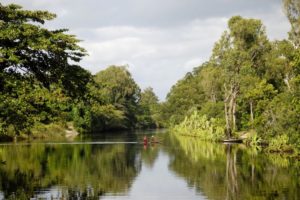
The Pangalan Channel is the longest and at the same time most most unknown channel in the world. While its famous cousins like the Suez Canal stretches over 165km and the Panama Canal over 80km, the Pangalanes measures a proud length of 645km. Its northern terminus is Tamatáve or Toamasina, the large port city on the east coast. The southernmost point is the village of Farafangana, also on the sea, but like much of the coastal towns, without a significant port function. The channel runs parallel to the coastline and the distance to the sea is only 100 meters in some places. On the fertile east coast of Madagascar, it cleverly follows the natural course of the lakes and rivers, which are abundantly fed with water from the forested highlands. Through Artificially created branch canals it advances in each case to the next - standing or moving - accumulation of water. Madagascar's numerous coastal peoples have always practiced intensive agriculture. Above all, the formerly valuable "colonial goods" have been Coffee, Cocoa, Vanilla, coconut, spices are still grown here today and can be enjoyed for example during a 4-day tour to the heart of the Sava region be acquired. Since there are few sufficient, paved roads in Madagascar, the channel is still today an important transport link and enables people in the first place to provide their goods not only for their own needs, but as a surplus for trade. The Canal des Pangalanes was built during the period of colonization by France. France played a significant role in the development of the island's infrastructure during its foreign rule. Roughly speaking, three phases can be distinguished.
The first phase: annexation and "pacification" of the country and the expansion of the Pangalan Canal.
When the French parliament decided to annex Madagascar at the end of the 19th century, the occupiers initially began to "pacify" the country. The previous French-Madagascan wars were, on the part of the French, above all through brutal military force characterized. The decline of the Merina monarchy proves that the Malagasy hardly knew how to resist the weapons of the Europeans. Although the Malagasy were not able to organize a united resistance, it took the "pacification" of the country a full eight years. Eight years in which the then governor Gallieni acted with cruel harshness against the protest of the Malagasy against their colonial masters. Countless villages were razed to the ground, and to this day the exact number of indigenous Malagasy who fell victim to the "pacification" of the country remains in the dark. Estimates put the number at more than 200,000 fatalities off.
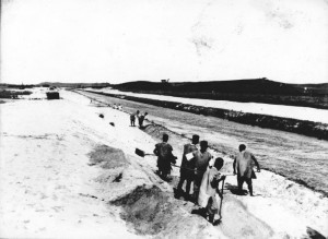
Since the large deployment of military and colonial administration resulted in immense costs, the occupiers quickly looked for Possibilities to get economic benefit from the colony. Since the fertile east coast region with its natural resources mentioned above urgently needed connection to an infrastructure, a canal seemed to be the simplest and most sensible solution that met several interests of the occupiers at the same time: On the one hand Goods and merchandise shipped along the east coast and on the other hand, the waterway offered the possibility of Rapidly deploy military contingents to be able to use force or tax impositions to bring down the recalcitrant coastal inhabitants. From today's perspective, therefore, the canal is the earliest evidence of Madagascar's economic exploitation. With enormous effort between 1896 and 1904 realized, the channel represents the up to most costly French colonial project to date It was even considerably more expensive than the famous "Yunnan Railway" in Indochina, which had cost 20 million gold francs. The excavation of the damp, impassable terrain demanded legions of forced laborers and countless fatalities.
The second phase: the construction of the railroad
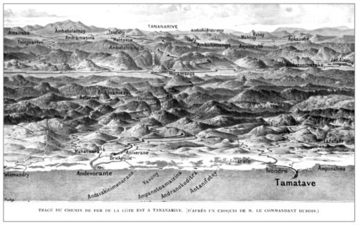
During World War I, France initially turned its gaze away from the colonies and instead toward theaters of war in Europe. With the End of the World War and the reparation payments guaranteed to France by the Treaty of Versailles, the French government could once again begin to extend its administrative influence over the colony and gain economic benefits from overseas colonies. The construction of the railroads of the Madagascar falls in this second phaseThe railroad line from Antananarivo to Antsirabe connected Madagascar's fertile "vegetable chamber" with the capital. Antananarivo to Tamatave ensured continuous transportation from the central highlands to the most important port on the east coast. With the railroad line, which extended from the then developed chrome and graphite deposits northwest of Lac Alaotra past this and the associated "rice chamber" of Madagascar to the capital, or more precisely to the coast, an important transport route for rice and industrially required raw materials had been created. Finally, the railroad line from Fianarantsoa to Manakara, built in the 1920s, connected the highlands to the coast - and especially to the canal. Colonial goods could thus be transported quickly and transshipped at the ports. Not until With the completion of the railroad lines, the Pangalan Canal was able to develop the economic dynamics that its builders had intended for it..
The third phase: 1940-1960
After France was defeated by Germany for the time being during the Second World War in 1940, the so-called "Vichy regime" was formed, which declared its loyalty to Germany. The troops stationed on Madagascar also pledged allegiance to Vichy, so that the colony was also attacked by British naval and air forces. In 1940, fierce air-artillery and naval battles raged around the town of Diego-Suarez before troops loyal to Vichy finally surrendered. The British then handed the island over to the government of "Free France" under Charles de Gaulle. The post-war government of Charles de Gaulle began the third phase of colonization in 1945: These were the years in which the many airfields, taxiways and other avionic facilities began in the year under review. In addition to military considerations, the needs of the numerous French settlers in the country were also at the center of the planning. Finally, in 1960, Madagascar gained its long-awaited independence.
The Pangalan Channel today
More than 50 years have passed since Madagascar's independence, and much of the colonial infrastructure in the country exists only in meager remnants. At least attempts are being made to rebuild the infrastructure created in the 2nd and 3rd phases of colonial history. "Routes Nationales"The most important road connections have been maintained to some extent with foreign help, and some of them have even been renewed. The number of airfields still in regular use, on the other hand, is declining. The rail network is also stagnating: Only the rickety "FCE" from Fianarantsoa to Manakara still ekes out a precarious existence. The rail link between Antananarivo and Antsirabe has been renovated and is ready for operation, but hopes of putting this important route back into service failed in 2009 when the putschist Rajoelina came to power and the ensuing National crisis 2009.
Similarly, the old route from Antananarivo to Tamatave has no or only limited passenger traffic: Very rarely run freight trains from the capital to the coast. Passenger traffic does not begin until Moramanga. The railroad line from Moramanga to Ambatondrazaka at Lac Alaotra is temporarily in operation, but here, too, it is only a matter of time until this means of transport will be replaced by a new one. underfunding due to corruption is set. Along the RN7 but can still have a Train ride to Manakara which guarantees passengers a view of breathtaking landscapes.
According to these examples of decay, the Pangalan Canal is no exception: due to the violent Weather changes, storm surges, floods and other environmental influencesThe course of the "Pangalanes" was not always easy by its nature. For a long time, however, attempts were made to keep at least the branch channels free and to allow traffic on the water to a large extent. In the meantime, serious signs of silting up of this great structure are becoming noticeable: It has not been possible to get through to Farafangana for years, even in the northern part of the canal only small sections are navigable, most of the intermediate sections have become impassable. The longest canal in the world, the former symbol of civilization and economic efficiency, silted up in the tropical stagnation.

