The geographical position of Madagascar
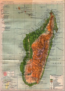
Madagascar is an island countrywhich means that several smaller or larger islands or parts of islands form this state. It is important that none of these islands is connected to the land area of a continent. In fact, this is not the case with Madagascar, because the island is approximately 600 kilometers from the east coast of Africa. In total, there are only four other islands in the world larger than Madagascar: Australia, Greenland, New Guinea and Borneo.
Madagascar covers an area of exactly 587,041 square kilometers and is home to more than 23 million Inhabitants. The coastline of the island state covers more than 4,800 kilometers and Madagascar is located in the Indian Ocean. It is not uncommon for scientists and experts to speak of Madagascar as if it were a separate continent. However, this is not at all due to the considerable size of the island, but because of the complete isolation in which Madagascar has spent many centuries or millennia. What exactly are the fascinating geographical features of Madagascar and what this means for you and your Trip to Madagascar The following article will describe what this can mean. However, it is important to bear in mind that we are primarily focusing on the basic information about the geographical position and situation of Madagascar have limited. In the further subitems you can then, if you wish more information to discover the islands of Madagascar, the provinces and cities, and the rivers and waters.
The formation of Madagascar
Madagascar is today an island, but many millions of years ago belonged to a so-called Supercontinent named Gondwana. This supercontinent sometimes had dimensions of more than 73 million square kilometers and included the now independent countries and continents of South America, New Guinea, Australia, Africa, Madagascar, India, Arabia and Antarctica. In the course of the Displacement of the so-called continental platesIn the course of history, Gondwana broke up into individual parts, one of which was able to assert itself as Madagascar as an independent island. Since Madagascar was formed at the latest 90 million years completely detached from the remains of Gondwana, the island existed since then as an independent island off the coast of Africa. The consequence of this development was that the Flora and fauna in Madagascar began to develop completely independently. Today, the relationships can hardly be reconstructed and many species that have long since become extinct in other parts of the world can still be found on Madagascar. This alone represents for many travelers a distinct advantage of a Madagascar vacation here: Here it is possible to immerse oneself in a world that is so completely alien to everything one is normally familiar with that the Trip to Madagascar developed into a spectacular and unforgettable adventure.
The exact characteristics of the island
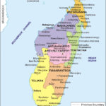
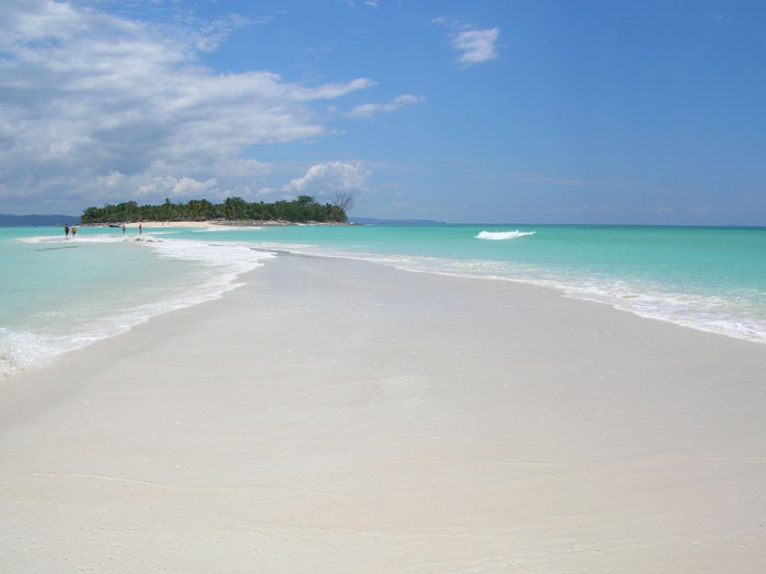
As noted above, Madagascar is currently located about 400 kilometers from the east coast of Africa. However, as the continental plates continue to move, it is quite possible that this position will change over the next few millennia. The island currently measures a Length of 1,580 kilometerswhen measured from the southernmost tip to the northernmost tip. In latitude, the island covers a maximum of 580 kilometers. Especially for those travelers who are on the island of from north to south or vice versa are on the road, this Journey through Madagascar to a real adventure, since the infrastructure in most regions is by no means up to the standards known in this country. The highest Madagascar mountain hears on the name Maromocotrowhich is 2,876 meters high and thus only undercuts the German Zugspitze by a little less than 100 meters. The largest city in Madagascar is also the capital of the island, Antananarivo. Other large and important cities are Antsirabe, Toamasina and also Fianarantsoa. Some islands lie in front of the Madagascar coast, which includes, for example, the island of Nosy Be, which is very popular with tourists.,/p>
The different zones of Madagascar
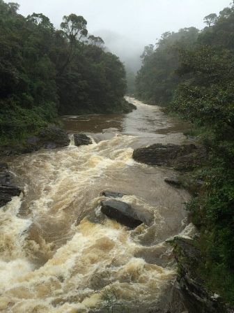
From a geographical point of view, Madagascar is divided into Five different zones divided into: the central highlands, the east coast, the Tsaratanana massif in the north of the island, the southwest and the west coast of the country. The central highlands are formed by a plateau that slopes gently from east to west. On the east coast, there are sometimes steep slopes, resulting in a characteristic step formation. On the east coast are also found the Rainiest areas of the islandThe most important part of the island is the coast, where not only the rough ocean influences the climate, but also the trade winds are most noticeable. On the following subpages we dedicate ourselves in detail to the geographical peculiarities of Madagascar. If you have any questions about this or any of our travel offers, we would be happy to hear from you.

